Category: Station Information
-
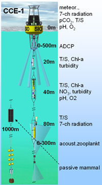
Sta 80.0 80.0
CalCOFI Station 80.80: lat 33° 29.0′ N lon -122° 32.0′ W (33.48333 -122.53335) is one of the primary station occupied on CalCOFI quarterly hydrographic survey cruises for over 70yrs. In March 06, 2011, a mooring (CCE-1) was deployed on sta 80.80. Real-time data can be viewed in the data section, and the sensor layout is…
-
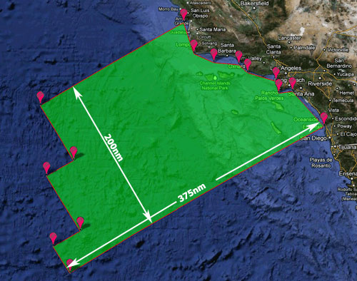
CalCOFI Working Area
CalCOFI’s sampling area has evolved over the 65 years of the program. The 66 standard station pattern in the Southern California Bight (SCB) has the best coverage since 1949. The current 75 station pattern, 66 standard + 9 SCCOOS 20m stations, was implemented in 2004. Refer to the Station Positions web page for coordinates for…
-
Survey Coverage 1937 – 2019
CalCOFI Station Coverage since 1937 Maps depicting Ichthyoplankton cruises (1937 to 1941) and CalCOFI cruises (1949 to present) Cruises from 1937 through 1987 are adapted from Hewitt, R.P. 1988. Historical review of the oceanographic approach to fishery research. CalCOFI Report, Vol XXIX. Cruises from 1988 to present are drawn from published CalCOFI data reports…
-
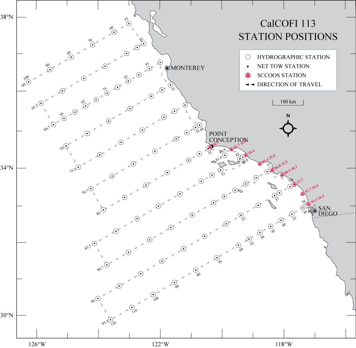
113 Station Pattern
During winter and spring, 113 stations have occasionally been occupied, weather & ship-time-permitting (25+ DAS). The 38 additional stations located north of Point Conception (lines 73.3 through 60.0) are surveyed but the ship may only stop when fish egg densities are high. Line 66.7, off Monterey, is part of the MBARI ‘SECRET’ time-series with stations…
-
75 Station Pattern
CalCOFI’s standard station pattern since 1984 includes 66 stations from San Diego to Pt Conception (Lines 93.3 to 76.7). Nine additional coastal ~20m SCCOOS stations were added July 2004. Thirty-eight additional stations off central and northern California are typically scheduled during winter and spring cruises, time and weather-permitting (Lines 73.3 to 60.0). A 73 station pattern…